|
|
 |
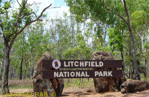
Lost
City in Litchfield National Park, Northern
Territory, Australia
|
|
|
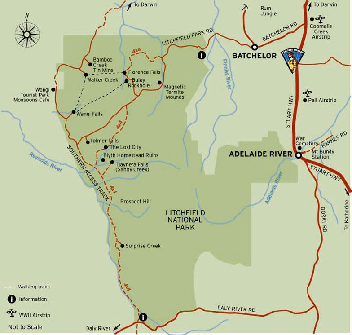
To
find the Lost City road access click on the map.
|
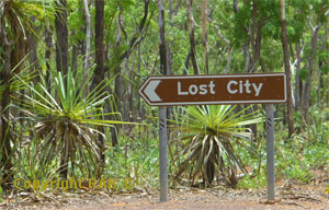
The
Lost City 4WD only check road conditions.
The Lost City, Litchfield National Park Free entry
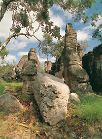
The Lost City is a spectacular sight, but the track
into this section is extremely rocky and rough,
and only people experienced in handling four-wheel-drive
vehicles should attempt the journey to the Lost
City. The only facilities is a car park. The Lost
City is a collection of rock formations that have
left behind as the softer sandstone cap of the table
top range eroded away. The Lost City became famous
with the old wagon road used by early pioneers passing
through this rock formation. The last couple of
kms of the current road follow the old wagon road
that joined the homestead of Stapleton Station near
Adelaide River to the outstation (Blyth Homestead).
How to get there - Near Batchelor,
100 km south-west of Darwin, the Park is generally
accessible all year (sealed roads) via Batchelor.
In the dry season it is also possible to get to
the Park via Cox Peninsula Road (which is unsealed).
When to visit - This Park is spectacular
at any time, though most 4WD tracks are closed during
the wet season. Generally open from May to November,
and admission is free. |
|
|
 |
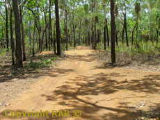
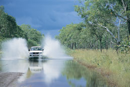
The approach
road is only a unsealed single lane track and that
leads past numerous termite hills and low lying
bushlands with an occassional inquisitive frilled
Necked Lizard looking on.. The track into this section
is very rocky and uneven and considered by us as
very rough so allow plenty of time to get there
and look out for oncoming driver's. The Lost City
can be access by horseback, trail bike, mountain
bike or to the hardy bushwalker. Only people experienced
in handling 4WD vehicles in uneven terrain should
consider attempting the track to the Lost City,
and their vehicle will need plenty of ground clearance
due to high rock ledges and sandbank drifts. The
track starts wide as in the photo's we took but
narrows and one-way for the most part then on. You'll
need to watch for oncoming vehicles and be prepared
to pull off the track to let them pass. After visiting
the Lost City try some bush walking, swimming and
relaxing around the surrounding plunge pools below
the magnificent Florence, tolmer and Wangi Falls
of Litchfield Park. Beyond the lost City are sandstone
blackened weathered escarpments and black soil plains,
occupied by numerous incredible magnetic
termite mounds, Then in patches with contrast
of pockets of monsoonal rainforests. Other remote
locations accessible on four wheel drive tracks
are Tjaynera Falls (Sandy Creek), the road to Blyth
Homestead accessible on four-wheel drive tracks.
|
|
|
|
|
 |
The Lost
City is a natural formation narrow passages and
domes of freestanding sandstone rocks. Formed from
rentless wet seasons rains and storms over millions
of years. One glance and you wonder who who built
and many of the formations resemble middle eastern
hill towns or ruins of medival cities. Every one
see the formations differently. It;'s the size of
a small village and be careful to get your bearing
as you venture thru the narrow alleys and pages
between the rock formations. © |
|
|
|
|
There are
three known Lost Cities icons in Northern Territory,
Australia.
- Lost City in Litchfield
National Park
- Lost City at Kings Canyon in Watarrka National
Park. Visitors can take a four-hour walk to
these unusual rock formations along a track
off the main road in the Watarrka National Park,
330km southwest of Alice Springs.
- Lost City at Cape Crawford, about 250km from
the Queensland border and 150km inland from
the east coast. Here, sandstone pillars rise
25m from the ground, in stark contrast to the
surrounding landscape. The only way to see this
Lost City is by helicopter. You can do a two-hour
tour, which includes a 1.5km walk around the
Lost City, or take a scenic flight.
|
|
|
 |
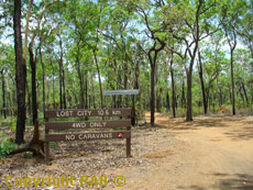
Blyth
Homestead - 4WD accessible. Access to the
homestead is by four wheel drive only. Accessible
via an 7.5 to 10.5 km four wheel drive track that
becomes rather difficult as you approach the this
rock formation. <<<<<
Example: The road will be subject to closure during
Wet Season. Warning many 4WD hire companies do not
allow hires permission to access Lost City in Litchfield
with their vehicles. We have no selfdrive hire vehicle
allowed for this area. |
|
|
|
|
|